 Products & Services
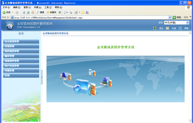
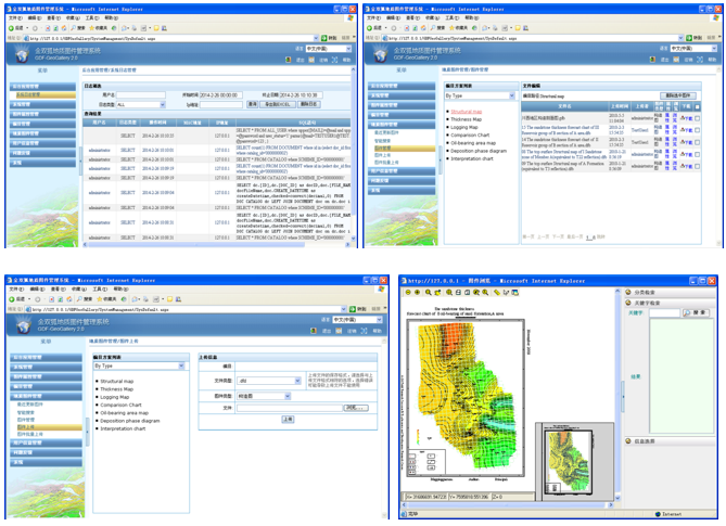
 It is a network management system for filing, managing and inquiring geological map on basic of database. The system can offer centralized storage, safety management for all kinds of oilfield geological maps, and functions of storing conveniently and quickly, systematic administration, version control, cooperative work, safe browsing and quick download


1、User location:
Each secondary sector oil
2、Features
•Flexible and convenient management of maps and drawings
•Safe and effective share of maps and drawings
• Intelligent and accurate searching of maps and drawings
• Reliable and user-friendly software functions
• DFDraw - bound and given
3、Features
I.Flexible and convenient management of maps and drawings
•Self-defining maps and drawings’ attributes
-Users are allowed to self-define such attributes of maps and drawings as well No., name of work area, year, etc.
–Attributes of maps and drawings can be used repeatedly.
–Searches based on the attribute of maps and drawings are available.
•Self-defining the type of maps and drawings
–Self-defining the type of such specialized maps and drawings as graphic log, structural diagram, etc.
–Self-defining the type of such specialized maps and drawings as graphic log, structural diagram, etc.
•Self-defining the option for cataloging maps and drawings
–Cataloging options of maps and drawings self-defined by users are enabled.
–Each map or drawing can be catalogued for a number of times so as to facilitate retrieving files by catalogue.
II.Safe and effective share of maps and drawings
• Encryption of maps and drawings is supported
–Contents of important maps and drawings can be encrypted.
–Attributes of important drawings can be encrypted.
•A system of subdivided authority control
–The data authority control extends up to individual map or drawing.
–Permissions can be granted for browse, print, download, release, –modification and other operations of maps and drawings.
–The revoking system for authorities is supported.
III.Intelligent and accurate searching of maps and drawings
•Search engine
–Automatic search of maps and drawings’ attributes
–Automatic search of the contents of maps and drawings in a txt format
–Automatically sequencing the display of maps and drawings in line with the click-through rate
•Maps and drawings’ attribute-based search
–Auto search by any attribute of maps and drawings.
•Maps and drawings’ content-based search
–Contents of maps and drawings in a txt format can be searched. Currently, plain-code formats like DFD, GXF and DXF are mainly supported.
IV.Reliable and user-friendly software functions
•A number of highly reliable versions of database are supported.
•Mass data management is supported
•Hardware solutions at the corporate level are supported
•Personalized user interface
•Multi-language support
•Convenient maintenance
•Multi-language support: one click to switch between Chinese and English interfaces.